
| Go to Allan's Page | Towing from Birmingham to Rickmansworth | Canals Home Page | Gloucester to Bristol | Go to Deb's Page |
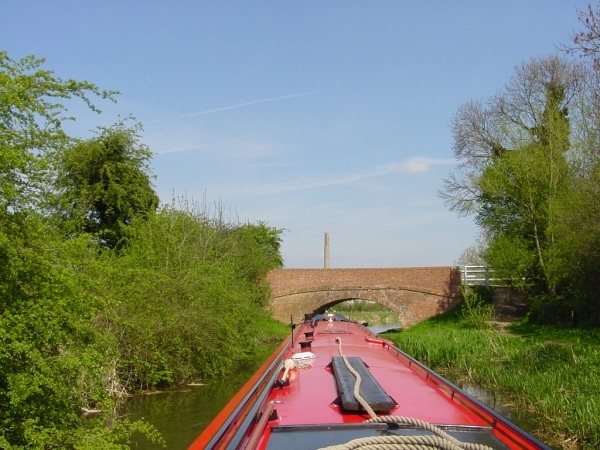
It wasn't long before we were on our travels again. It was St George's day, and the weather had warmed up nicely, but the rain had swollen the rivers so we knew that we might have to wait a while before we could continue down the Nene. By chance we stopped at The Boat Inn at Stoke Bruerne for our first night, and unexpectedly joined their fabulous St George's Day celebrations. I've never seen so many Morris Dancers in one place at the same time, and I'll never forget being woken by the sound of a group of dancers trying to tiptoe quietly along the towpath back to their own boats after a few beers late at night, while still wearing the bells on their costumes! Next morning the recorded announcement from the Environment Agency told us they had taken the Strong Stream Advice off the River Nene, so we hurried down the Northampton flight and on to the Nene. The river was still quite high, so we had to remember to take down the chimney and the TV aerial before setting off as there was absolutely no spare clearance under some of the bridges, but with plenty of water to help us along we made a remarkably quick trip to Peterborough. We were disappointed that many of the casual moorings shown on our map were totally unsuitable for a narrow boat, so we often travelled on further than we had intended looking for a place to stop overnight. Just 4 days after leaving Stoke Bruerne we were comfortably moored at the 'Dog and Doublet' to meet our daughter and grand-daughter for the night.
|
|
|
|
|
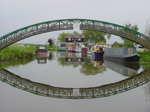
Morris Dancing at Stoke Bruerne |
Northampton Arm |
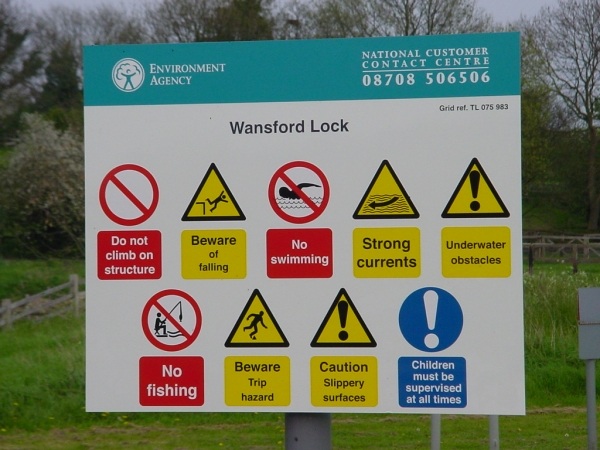
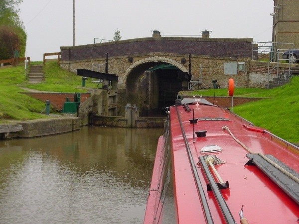
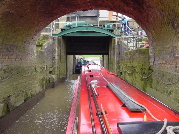
Dangerous places, these locks! |
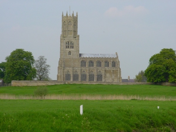
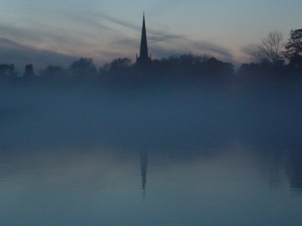
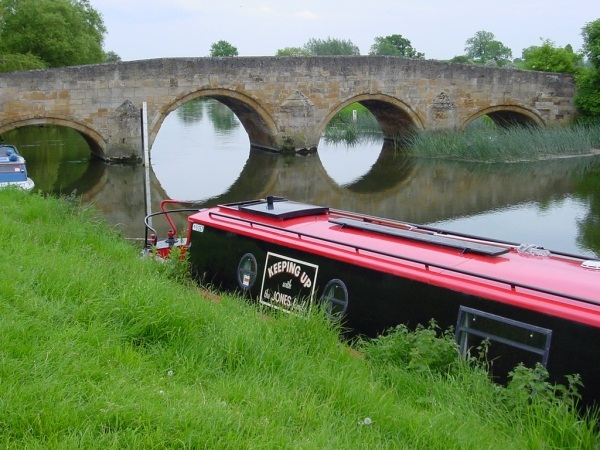
Fotheringhay Church |
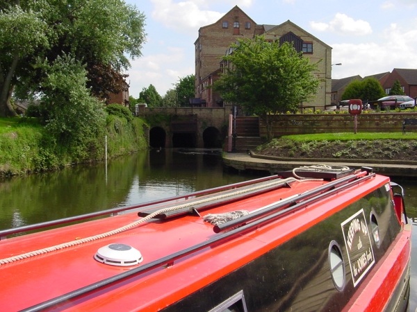
The next day we had change of pace as we came back to Peterborough and entered the Fenland waterways. It was difficult getting used to the idea that you have to phone each lock-keeper 24 hours ahead to book passage through their lock. Stanground sluice is fascinating; the lock has been lengthened at the lower end to take full-length narrow boats, but there is still a bridge across the original lock tail so that anything taller than a narrow boat must be no longer than the original lock. Soon after that, at Whittlesey, is a sharp narrow bend that has been lengthened so that a narrow boat can get round it, and now it's not really much more difficult than some of the bends on the South Oxford canal. There are few towns, but there are good moorings in all of them, especially in March which is also has plenty of shops. Some of the waterways are deep, wide, and completely straight, whereas others are shallow, narrow, and twisting; it is generally very peaceful and there is plenty of variety.
 |
 |
 |
 |
At the Dog & Doublet near Peterborough |
Typical Fenland scene at the Dog & Doublet |
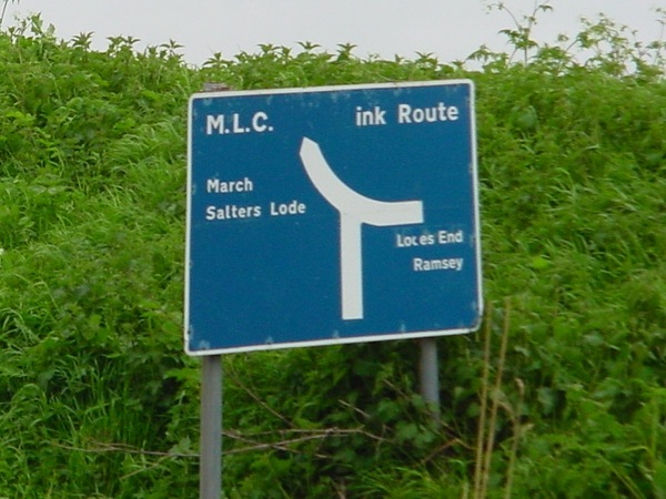
Fens signpost |
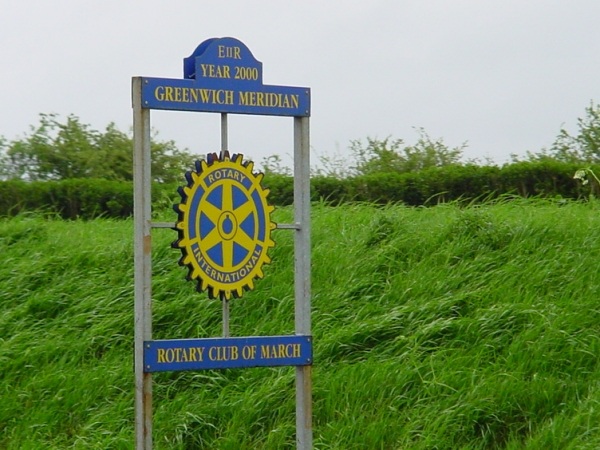
Crossing the Meridian |
The main restriction to our travelling on the Fens (or Drains, or Sewers, depending on how old your map is) came from the lack of headroom under the bridges, which can vary from day to day according to what the weather is doing and how actively they are pumping the Fens at the time. Some of the maps don't seem to record the heights very consistently, so on one occasion we had to stop and remove everything from the roof to get under a bridge where we were supposed to have 2'6" of clearance. Sometimes we couldn't even recognise the bridges when we came to them, as they didn't always look like bridges; there might be just an 8-foot square hole in an otherwise blank brick wall, which you couldn't see through, but you just turned in, ducked down, and hoped for the best. It took me a while to understand that a 'cock-up' bridge is NOT one where you've made a mistake.
 |
 |
 |
 |
Basil's Point at Salter's Lode (Basil is the dog) |
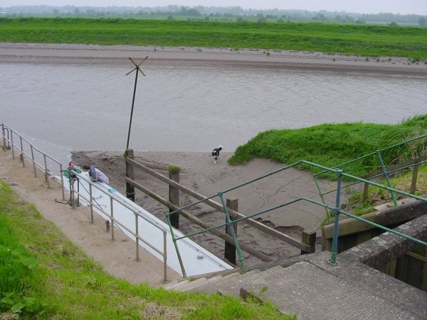
Waiting to enter Salter's Lode Lock |
About to enter Salter's Lode Lock |
Passing through Salter's Lode Lock |
There is a short tidal stretch to cross, from Salter's Lode to Denver. Salter's Lode lock has also been lengthened to take narrow boats, but the procedure for southbound traffic is quite complicated as they use a new pair of additional gates that have no balance beams. These gates have to be winched open and shut with wires that the lock-keeper clips on to the ends of the gates themselves, using 12-volt winches on the bank that are powered from a car battery that the lock-keeper carries around the lock. Northbound traffic entering on a falling tide has an easier time, for instead of using these gates the lock keeper just waits until the tide is at the same level as the water in the Drain beyond, then opens the gates at both ends of the lock so you can go straight through. The lock keepers at Salter's Lode and Denver were incredibly helpful, and we were delighted to be accompanied along this section by a playful seal.
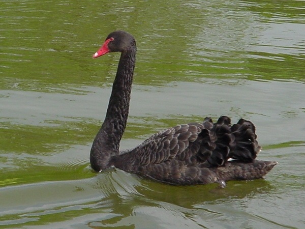
Ely was a delightful place to stop, although it gets quite crowded. We spent a happy day exploring the town with its cathedral, markets, and antique centres. Unusually there is a pair of Black Swans at Ely, one of only a couple of wild breeding pairs in England. Generally though, we found the lower stretches of the Great Ouse to be rather uninteresting, and we hurried on up-river to the Old West River which is as beautifully peaceful as you could want. The water level was very high at Earith, which made it very worrying to come up in the lock which has a fixed road-bridge over it, with less then 3"" clearance over the roof when the lock was full; and the river was very high to St Ives where we stopped for a few days; the Bank Holiday market was wonderful, although the weather was dreadful, and the town was well worth exploring (it also has the best off-licence I've ever seen, with a fabulous selection of Scotch Whiskies).
 |
 |
 |
 |
Seal near Earith |
Misty evening at St Ives |
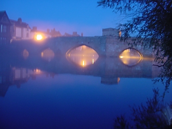
St Ives bridge at night |
Black swan at Ely |
After checking with the EA for any strong-stream warnings we set off again but after a terrific struggle against the current, we arrived at Godmanchester to find the lock gates chained open and the lock moorings rapidly disappearing under the rising waters. When we phoned the EA again to ask what was happening they said "Didn't you know, we closed the river 3 hours ago. You'll be stuck there for about a week, you'll be better off waiting in the lock" so we tied up in the lock and waited for the floodwaters to subside.
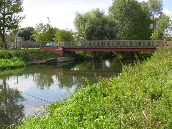
Even when the river was re-opened the current was very strong as we fought our way upstream, through white water rapids at one point below St Neots, to get to Bedford. The bridges here were very low indeed, and I had to get the toolkit out and remove even the flexible rubber radio aerials before we scraped through with less then a quarter inch of clearance. But as the river was so high, once under the bridges we were able to get all the way up to Kempston Mill; and after three weeks of travelling we were less than 12 miles from our starting point! The current up to Kempston was really fierce, and it took us 4 attempts to get far enough above the winding point that we could drop the stern back into it and let the river swing the bows dizzily back towards Bedford again. It had taken us 3 hours to fight our way upstream from Bedford to Kempston; the trip back was a 45-minute rollercoaster ride; and it takes some nerve to pass under a bridge at nearly 10mph, knowing that there is less than an inch of clearance over the roof and that there is no way you could stop with so much current behind you even if you wanted to.
 |
 |
 |
 |
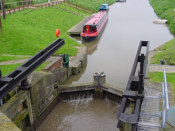
In Bedford Lock |
Near Kempston (on a calmer day) |
Kempston (on a calmer day) |
The "Fish & Duck" |
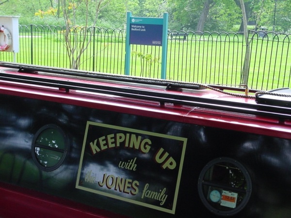
On our way back downstream we met another seal at Earith. This one was sunbathing on the bank, and she is apparently so friendly that she sometimes swims into the marina and climbs out on to the pontoons. Then we turned up the Cam and visited Cambridge, but we didn't stop there as it was too crowded for us; instead we went back to the "Fish and Duck", a pub so remote that the best description of its location is "2 miles from the pub that's called 'The 5 miles from Anywhere'". On the way we tried to go up the small Burwell creek but contrary to the advice we'd been given, we couldn't fit through the entrance lock (and reversed out very hurriedly when we read the notice that said the guillotine would descend automatically after 15 minutes!). But we did go up three of the smaller rivers there: the Little Ouse, the Lark, and most beautiful of them all well into Norfolk on the Wissey. In each case we were rather worried about finding room to turn at the far end, but we managed it quite easily in each case (although we did have to turn before the locks which were too short for us on the Lark and Little Ouse).
 |
 |
 |
 |
Jesus Lock, Cambridge |
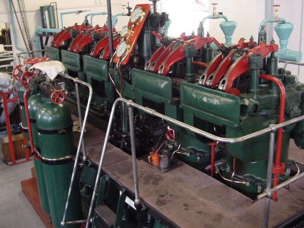
Pumping engine at Prickwillow |
Ramsey |
Fotheringhay on the River Nene |
We finally crossed the eastern Great Ouse tideway again, passing through Salter's Lode with all the gates open, to spend a few more days exploring the Fens before returning to the Nene. We didn't like the idea of staying overnight on the main embankment in Peterborough so journeyed a little way upstream and turned off the river up an un-signposted entrance which wasn't on our map, to find that it led to a delightful lake next to the rowing course, with excellent moorings and a good pub to eat in. The Nene was still very high, so we had to be careful in the locks where the water was pouring heavily over the top gates. I'd always wanted to visit Wadenhoe, so when we got there in time for lunch a couple of days later, after going up the lock we let the boat drift backwards a short way down the weir stream and found an excellent mooring on the pub garden. We stayed there until the next morning, enjoying the hospitality of the pub and exploring this beautiful, timeless village, before finally heading back up-river to the Northampton Arm and home to Stoke Hammond.
| Go to Allan's Page | Towing from Birmingham to Rickmansworth | Canals Home Page | Gloucester to Bristol | Go to Deb's Page |
All pictures on this site are © Allan Jones unless otherwise stated
![]()